Under an hour
Short and easy
Sentinel Rock and Peters Pool
Compare the tracksExplore the stops
Franz Josef: Franz Josef Glacier Lookout Guided Walk
★ 4.8 · 169 user reviews
Map of 11 stops
Choose a route and tap a pin or stop to see its note and open it in Google Maps.
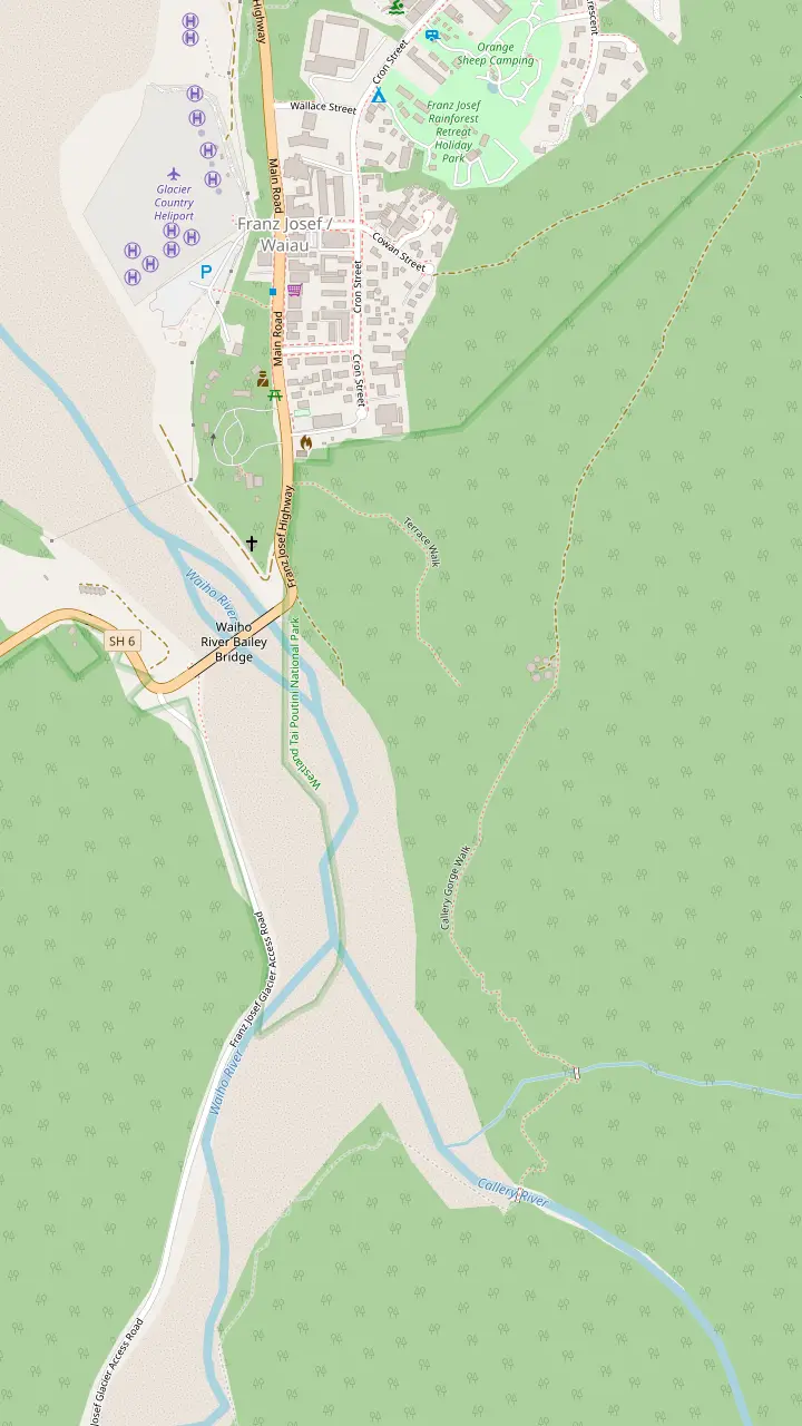
The village sits only a few kilometres from the glacier.
Google MapsTerrace Walk is 1.8 km return and takes 30 min.
Google MapsThe Tatare Tunnels Walk begins at the end of Cowan Street.
Google MapsThe Callery Gorge Walk is 5.2 km return and takes 1 hr 20 min.
Google Maps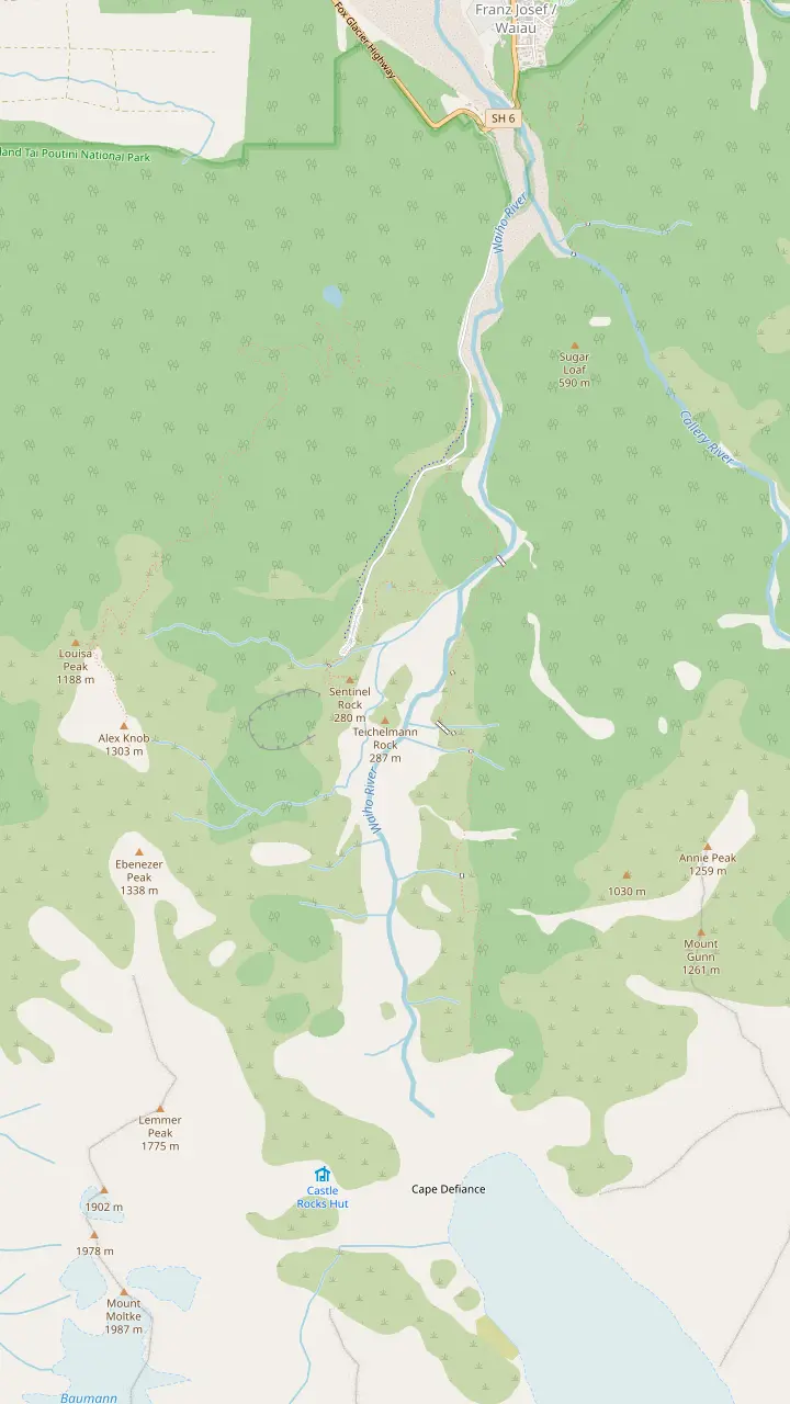
Alex Knob Track starts 2 km along the glacier access road.
Google MapsLake Wombat Walk is 3.8 km return and takes 1 hr 30 min.
Google MapsPeters Pool Walk is 1.1 km return and takes 25 min.
Google MapsSentinel Rock Walk is 900 m return and takes 20 min.
Google MapsThe Douglas Walk is 3.9 km return and visits the historic Douglas Bridge.
Google MapsIn around an hour Roberts Point Track reaches Hende's Hut, a sheltered lunch spot.
Google MapsRoberts Point is a lookout only, with no access onto the glacier.
Google Maps© OpenStreetMap contributors, map data
From a 20-minute stroll to an all-day climb, the tracks around the glacier suit every pair of legs and every mood. Here is each one with its distance, time and grade.
Editorial team, franzjosefquadbiking.com · Updated November 6, 2026 · Read in 8 min
In brief
There are about 30 different walking tracks in Glacier Country, from short scenic tracks to challenging multi-day hikes.6 Around the glacier itself, the useful ones fall into groups: short walks beside the car park, forest walks with a pool or a lake, and long climbs to high lookouts. Pick the group first, then the walk. A Franz Josef glacier hike in the strict sense of the words means the long tracks, but the gentler ones are the right start for many days.
Whichever Franz Josef glacier walk you pick, think about daylight and weather before distance. The national park lies in the path of prevailing westerlies, which can bring heavy rain at any time of the year.7 Weather conditions change dramatically in a short space of time, so a walk that looks easy on the map can feel serious in a squall.8 Carry warm and waterproof clothing at all times, whichever walk you pick.9
Check conditions with the people who maintain the tracks. The regional tourism group points walkers to the Department of Conservation visitor centre for weather conditions, hiking guides and personal locator beacons.10 The centre is at 69 Cron Street and opens daily from 8:30am to 5:00pm, except Christmas Day.11,12 A stop there before a long walk is cheap insurance, and the advice is free. Ask about the creeks, the cloud level and any closed sections before you commit to a plan.
Tracks compared
| Walk | Time | Grade | Starts at |
|---|---|---|---|
| Sentinel Rock | 20 min1 | Easy short walk1 | Valley road14 |
| Peters Pool | 25 min2 | Accessible short walk2 | Valley road14 |
| Douglas Walk | 1 hr17 | Easy to intermediate17 | Valley road14 |
| Lake Wombat | 1 hr 30 min3 | Easy to intermediate3 | Road, 2 km along25 |
| Tatare Tunnels | 1 hr 20 min23 | Easy to intermediate23 | Cowan Street26 |
| Roberts Point | 5 hr 20 min4 | Advanced tramping4 | Valley car park27 |
| Alex Knob | 8 hr5 | Advanced tramping5 | Road, 2 km along25 |
Times and grades are the Department of Conservation's; always check track conditions at the visitor centre first.
Sentinel Rock Walk is the quickest way into the valley. It is 900 m return, takes 20 min and is graded an easy short walk.1 At the top, information panels show photos of the glacial retreat, which makes the view mean something.16 For a Franz Josef glacier valley walk with the least effort, this is the one to start with, and it still rewards you in poor weather, when cloud sits low on the valley walls.
Peters Pool Walk is 1.1 km return, takes 25 min, is wheelchair accessible and winds through rainforest to a small kettle lake.2 The lake formed when ice melted amongst glacial moraine about 200 years ago.20 On a still day the glacier and the mountain peaks reflect in the water, which makes it a gentle stop for children and for anyone with limited mobility, and a nice place to sit.
The regional walk list also gives a short walk to a glacier viewpoint, 30 min and 1.7 km return, suitable for children.21 Another option is Canavans Knob Walk, a short climb with views of the glacier, mountains and river flats, taking 1 hr to 1 hr 40.22 Both start from the valley road, and both give you the shape of the valley, the river bed and the ice without any scrambling or route finding.
The Douglas Walk is 3.9 km return, takes 1 hr and is graded easy to intermediate.17 It crosses glacial landforms that formed between 1600 AD and 1750 AD, then passes through a series of vegetation types that mark different stages of regrowth behind the retreating ice.18 It also visits Peters Pool and the historic Douglas Bridge, so it combines both sights in a single loop.30
Lake Wombat Walk is 3.8 km return and takes 1 hr 30 min.3 It climbs steadily through rimu forest to a peaceful lake, and the lake is a kettle lake, formed about 9000 years ago by a huge piece of ice left amidst glacial debris.31 The track starts 2 km along the access road, so you can pair it with the Alex Knob start without driving back to the car park.25
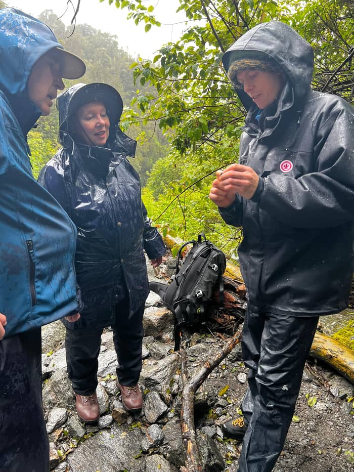
Both of these are good choices when the cloud is low. The forest does not need a clear sky, and the birdsong carries on regardless. Wear shoes with grip, since roots and wet rock make for slippery footing, and keep to the track. A flask of tea at the lake turns a plain walk into a real outing, and the forest is quiet enough to reward a patient listener with birdsong and the drip of rain.
Match your legs
Pick the line closest to your plans and the answer sits beside it
If I have 20 minutes and a camera
Walk Sentinel Rock
If I am with a pram or a wheelchair
Take Peters Pool Walk
It is a fully accessible walk to a kettle lake.2
If I want forest and a lake
Walk to Lake Wombat
It takes 1 hr 30 min return through rimu forest.3
If I want the best view on foot
Climb Alex Knob
It gives the best views without a helicopter flight.28
If The weather is poor in the valley
Try the village walks
Terrace Walk is 30 min and the Tatare Tunnels need a torch.13,29
Three kinds of walking day
Under an hour
Sentinel Rock and Peters Pool
Compare the tracks
A relaxed half day
Douglas and Lake Wombat
Compare the tracks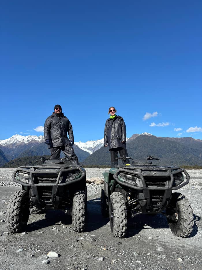
A full effort
Roberts Point or Alex Knob
Compare the tracksRoberts Point Track is 12.3 km return, takes 5 hr 20 min return and is graded an advanced tramping track.4 It starts as the Douglas Walk, then crosses Douglas Bridge and climbs the true right of the valley.27 In around an hour the track opens out onto rock outcrops at Hende's Hut, a sheltered lunch spot.32 Hende's Gallery, a cantilevered balcony, dates from 1907.37
The final lookout shows the glacier, rock walls, waterfalls and peaks, but the track does not provide access onto the glacier.33 It is best attempted in fine weather, because of unbridged stream crossings and rock slabs that are very slippery when wet or icy.38 Several people have lost their lives on this hike, so be honest about your fitness and turn back if the creeks are running high.39
Alex Knob Track is 17.2 km return, takes 8 hr and is graded advanced, yet the Department of Conservation says it gives the best views of the glacier without taking a helicopter flight.5,28 It starts 2 km along the access road, and the Rata lookout takes about 2 hours to reach.25,40 In summer, start early to avoid afternoon cloud.36 Pack food, water and layers, and carry a locator beacon if you can.
Price a guided day
Type your party size and compare four ways to go further
Compare 4 side by side
Type your party size and compare four ways to go further
≈
View≈
View≈
View≈
ViewCurrency conversion uses the ECB reference rate on GetYourGuide from-prices. The exact price is displayed when you book.
A full day of walks
Morning
Start in the village on a 1.8 km return walk through bush.13
Mid-morning
Before lunch
Midday
A 1.1 km return walk to a kettle lake.2
Afternoon
Evening
Return to Terrace Walk after dark with a torch.19
Terrace Walk is 1.8 km return, takes 30 min and is an easy short walk along bush-clad terraces at the south end of the village.13 Take a torch and explore it at night to see glow-worms, especially under large fallen trees.19 There is no access beyond the seats at the end because of a slip, so you turn back where the track stops.41 It is the easiest evening outing in the village.
Tatare Tunnels Walk is 3.6 km return and takes 1 hr 20 min, graded easy to intermediate, and it starts at the end of Cowan Street.23,26 Pioneer miners drove a 500 metre tunnel system to pipe water to the Waiho terrace.42 You will need a torch and raincoat to explore the tunnels, and the track stops just inside the far end of the first tunnel.29,43
The Callery Gorge Walk is 5.2 km return, takes 1 hr 20 min and shares its first five minutes with the Tatare Tunnels Walk.24,44 It follows an old gold mining water race, and the rusty relics are among the last visual reminders of the gold mining era.45 Te Ara a Waiau, for walkers and cyclists, runs from the township to the glacier car park, 8.7 km return.46 Together these make a full day of walking without ever driving.
Video
The NZ Brits on YouTube · Nothing is fetched until you hit play.
the best views of Franz Josef Glacier/Kā Roimata o Hine Hukatere without taking a helicopter flight
Before you step out
The Department of Conservation charges for parking at the glacier car park: NZ$2.50 per half hour or NZ$20 a day, and it is free if you arrive and leave within 10 minutes.47 Payment machines accept cards, and cash is not accepted.15 Most of the walking tracks are reached from the car park at the end of the 4 km access road.14 Walks that start in the village, such as Terrace Walk, avoid the fee altogether.13
The valley is dynamic and potentially hazardous. River levels and water channels can change rapidly, particularly during and after heavy rain, and the entire river bed can become covered with flood water.48,49 When conditions are considered unsafe, a sign is placed across the track to show the limit of safe access.35 Do not try to cross the Callery or Waiho rivers on foot, as both are very swift, cold and dangerous.50
Flush toilets stand at the car park and none further up the valley.51 No rubbish bins are provided, so carry out what you carry in.52 Do not feed the wildlife, particularly kea, and do not fly a drone without a permit.53,54 The ice itself is off limits: collapse and rock fall can occur at any time at the terminal face, so stay behind the rope barrier.55
A guided walk takes the planning out of a day. The Glacier Lookout Guided Walk is listed from $65, lasts 3 hours and is limited to 10 participants, with a live guide in English. Guided eco hikes are also available up both glacier valleys, getting close to the glacier without walking on the ice.56 This suits first-timers and families who would rather have a local read the river and the weather for them.
If you want to walk on the ice, no track will take you there. A guided heli-hike is the route. The Viator listing runs 4 hours for groups of up to 11 and is listed from $530. The other glacier hike with a helicopter transfer is listed from $528, with up to 2.5 hours of guided hiking. Both depend on weather, so leave a spare day in your plan if you can.
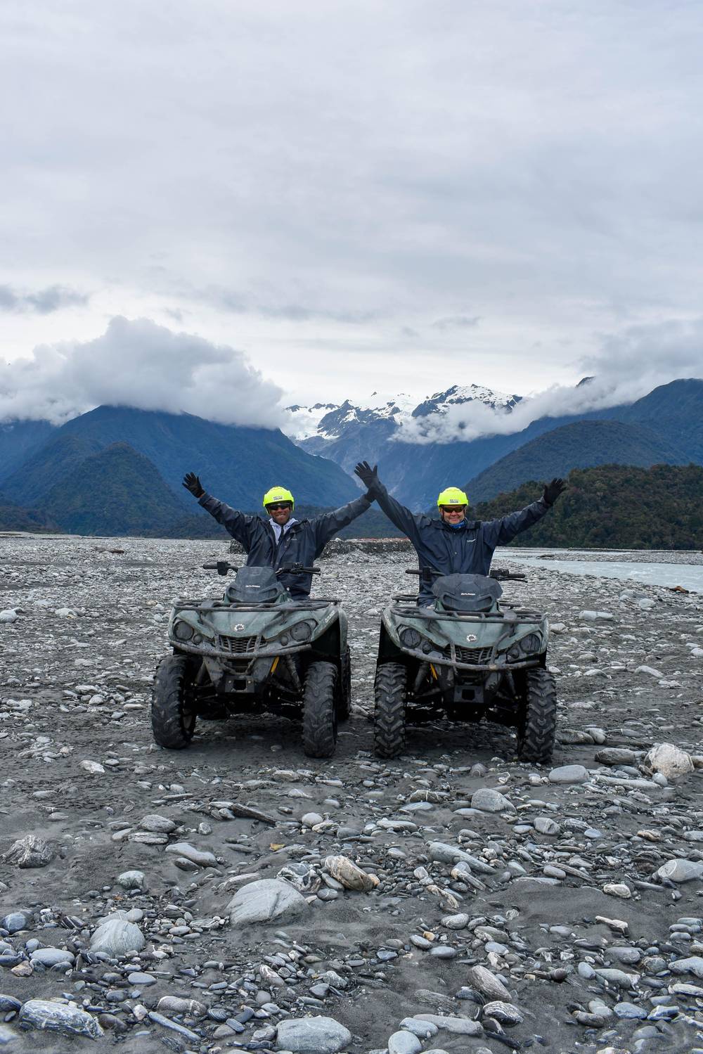
For a change from walking, this site's quad tour is a 2-hour ride through the national park's rainforest, rivers and glacial pathways, listed from $104 per person. It suits a day when your legs are tired, the cloud is down or the rain makes a long walk unattractive, and a hot soak in the village afterwards makes a fine end to the day.
FAQ
It is 1.1 km return, takes 25 min and is wheelchair accessible.2
Ice collapse and rock fall can occur at any time at the face.55
The Department of Conservation says it gives the best views without a flight.28
Take a torch at night and look under large fallen trees.19
A sign across the track marks the limit of safe access.35
Sources
More to read
Wondering if a quad ride at Franz Josef suits you or your kids? A real person answers here.